Spook Creek, connecting the Lower Escarpment and Waterfront trails
September 10, 2018. Exploring Spook Creek in Whitehorse, Yukon
Part of the Downtown South Master Plan is a formalization of a trail along the foot of the escarpment. The planned Lower Escarpment Trail runs from the South Access and ends at the Black Street stairs. A needed step is to extend the Lower Escarpment Trail north from the Black Street stairs, along the base of the escarpment. The trail would end at the intersection of 2nd and 4th avenues in fromt of Northern Industrial Sales. 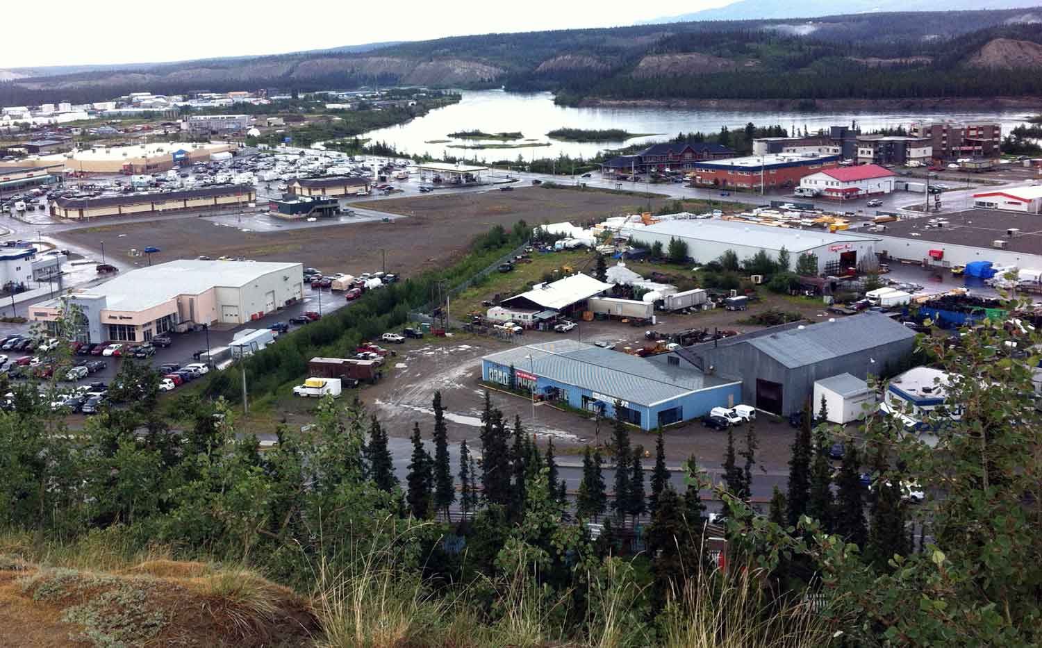
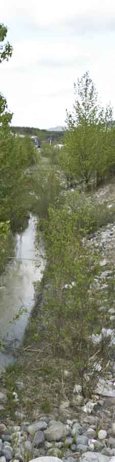
Then, a very short walk up Two Mile Hill is Spook Creek. Spook Creek then runs through an easement across the now empty field between the car dealerships and the current businesses on 4th Avenue and ends by Spook Creek Station.
It's the green strip in the photo here that is running up in back of the Argus property. Let's make this a Spook Creek trail/parkette with a paved wheelchair-accessible trail, complete with flowers, trees, benches, lights. It would formally link the Lower Eescarpment Trail with the Waterfront Trail at Spook Creek Station. The map shows the connection from the Black Street Stairs to Spook Creek Station. Both road crossings are at traffic lights with pedestrial signals.
This will connect the escarpment to the waterfront and provide walkers with a great new set of loop trail walks. It might even encourage the Walmart campers to venture out of their safe haven and see our city!
Marwell Background
- Spook Creek drainage Yukon Envirothon. The Spook basin is the focus of a wide variety of studies that has been the focus of five different Yukon Envirothons. Provides a collection of information associated with the Envirothon: three themes: Maps, Reports and land use.
- Extricating ChevronTexaco from Whitehorse, Yukon: A forensic exercise, Hoenke An interesting slideshow on the Marwell contamination problems
- Adopt a stream Would this 2004 program, and Spook Creek be a good Downtown Residents Association project?
- Development of a Fish and Fish Habitat GIS talks about the Marwell area and Spook Creek.